Munich bike map
You can find on this page the Munich bike map to print and to download in PDF. The Munich bicycle map presents the bike routes and lanes of Munich in Bavaria - Germany.
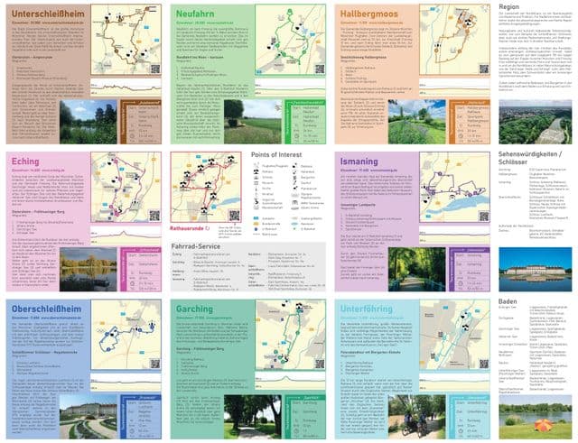
Munich bike lane map
The Munich bike lane map shows all the bike routes of Munich. This bicycles lanes map of Munich will allow you to easily plan your routes with a bike in Munich in Bavaria - Germany. The Munich bike lanes map is downloadable in PDF, printable and free.
With its approx. 1.200 kilometres of marked bike lanes and some 22,000 bike stands, Munich infrastructure is first-rate. In Munich, biking and public transport are a great combination. At underground and S-Bahn stops, you will find numerous parking spaces for bikes. In addition, there is a Bicycle Day Pass that allows you to use any S-Bahn and underground as well as certain regional trains at the times indicated. Cyclist are allowed to ride side by side unless this poses dangerous situations. The maximum speedlimit on these bike lanes is 20 km per hour as its mentioned in Munich bike lane map. Children under the age of 8 must use the side walk and are not allowed to use the bike lanes. Munich lies about halfway between the source and the mouth of the River Isar, so the Isar Cycle Path can be followed for about 150 kilometers (90 miles) in either direction. As it runs along the river, It is mostly flat and passes pretty towns, historical castles and idyllic nature reserves.