Munich topographic map
You can find on this page the Munich topographic map to print and to download in PDF. The Munich elevation map present the topography, river and relief of Munich in Bavaria - Germany.
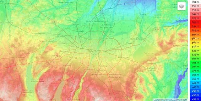
Munich elevation map
The Munich topographic map shows elevation, hills and landforms in Munich. This elevation map of Munich will allow you to know topography, river and relief of Munich in Bavaria - Germany. The Munich topographic map is downloadable in PDF, printable and free.
Munich lies on the elevated plains of Upper Bavaria, about 31 miles (50 km) north of the Alps, in the Northern Alpine Foreland, at an altitude of about 1,700 feet (520 elevation meters) as you can see in Munich elevation map. The northern part of this sandy plateau includes a highly fertile flint area, while the southern part is covered by morainic hills. Around Munich there are fields of fluvio-glacial out-wash. Wherever these deposits get thinner, the ground water can flood the area, leading to marshes, as in the north of Munich. The local rivers are the Isar and the Würm.