Munich tram map
You can find on this page the Munich tram map to print and to download in PDF. The Munich trams map presents the network, zones, stations and different lines of the tramway of Munich in Bavaria - Germany.
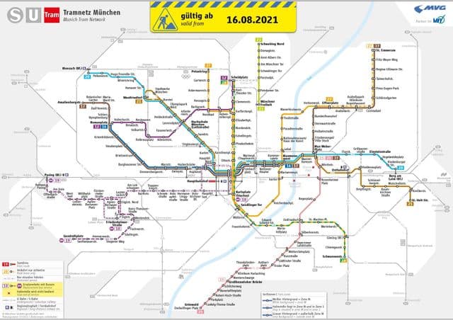
Munich tramway map
The Munich tram map shows all the stations and lines of the Munich tramways. This tramway map of Munich will allow you to easily plan your routes in the trams of Munich in Bavaria - Germany. The Munich tram map is downloadable in PDF, printable and free.
The Munich Tramway ( German : Straßenbahn München , also called Tram and Trambahn ) is an eleven-line tramway operated by Munich City Utilities subsidiary Munich Public Transportation Company (MVG) as part of the Munich Transport and Tariff Association (MVV) transit area. The network is 75 kilometers (47 mi) long, operated by 95 trams transporting 94 million people in 2008. The network has 155 stops as you can see in Munich tramway map. There is a night tram service with four routes. The system uses standard gauge , unidirectional trams and 2.3 meters (7 ft 7 in) wide bodies.